 CAMPGROUNDER
Open it. The map gets a page of its own.
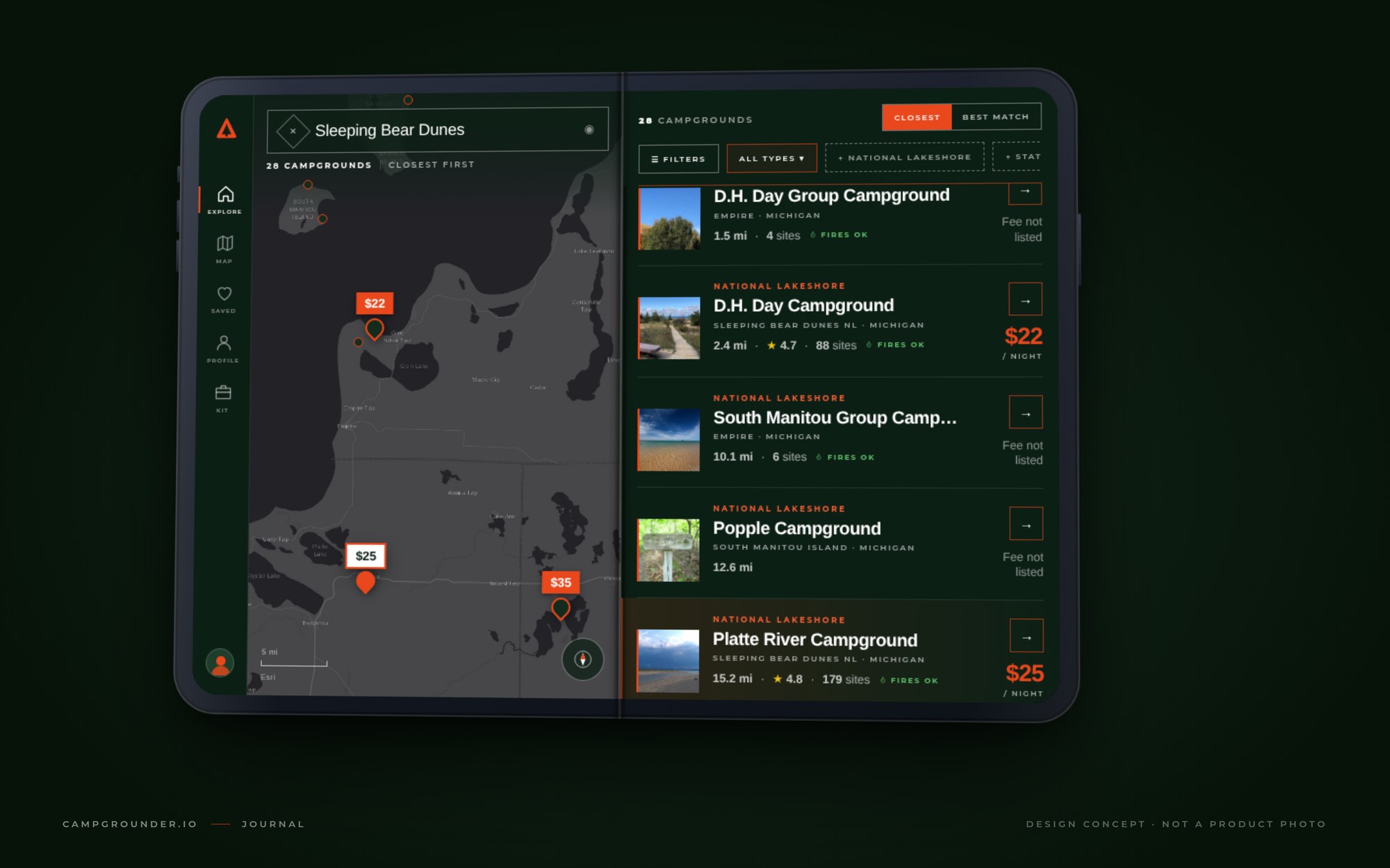
Apple announced the iPhone Duo on Wednesday. It's the first iPhone that folds, and closed, it's shaped like a passport. We spent the next day thinking about what a campground app should do with a second page.
This is what we came up with. It's a concept, drawn from the shipping app and Apple's published measurements. Nobody outside Apple has held one yet, and neither have we.
It's two pages, not one big one
The interesting number isn't 7.6 inches. It's the shape. Open, the Duo is 164.6 mm wide and 117.8 mm tall, and each half of that is almost exactly the outer screen. So the inside isn't a small tablet. It's two phone screens side by side, with a hinge where the gutter of a book would be.
That changes what the app should do. On a phone you toggle: List or Map, one at a time, and you flip back and forth while you decide. On the Duo the toggle can go away. The map takes the left page and the list takes the right one, and tapping a pin lights up its card across the hinge instead of covering the map.
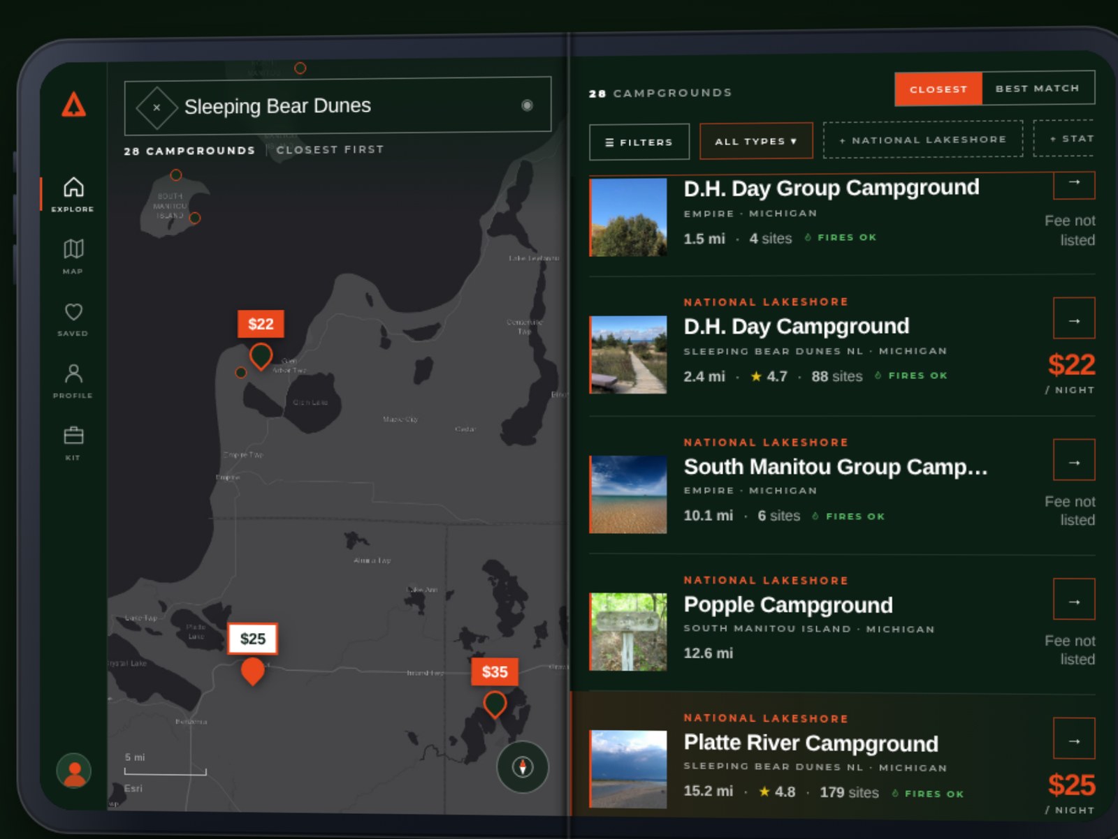
What's in the picture
Everything on those screens is real. We ran the search for "Sleeping Bear Dunes" through the same ranking the app uses today. It found 28 campgrounds and ordered them closest first, because a list you didn't ask a question of is sorted by distance and says where from. D.H. Day is 2.4 miles out. Platte River is 15.2. Interlochen State Park is 21.9. The fees, the site counts and the photos are what the listings show right now.
The base map is the same one the app draws, and the pins are the app's pins. The rail on the left is new, and so is the idea of a card that stays lit while you look at the map. Both are cheap to build. The map and list toggle exists because a phone is narrow. Give it two pages and the reason goes away.
What happens when you fold it
Apple says content on the Duo reacts as it folds and moves to the other screen when you close it. Here's how we'd want that to feel at a trailhead with no signal.
You've got the map open on the left and Platte River lit on the right. You close the phone to put it in a pocket. The outer screen should show Platte River, not the map, because that's the thing you were looking at. Open it again and the map should be exactly where you left it, same zoom, same pins. Nothing reloads and nothing forgets.
That part we can't test from a drawing. It needs the hinge, the crease and iOS 27.1 in hand, and it needs the app to know which page you were reading when the light went out. We'll find out in October like everyone else.
Display sizes, resolutions, dimensions, price and release date are from Apple's iPhone Duo technical specifications and the announcement. The device in the pictures is a drawing at those proportions, not a product photo, and Apple hasn't reviewed or endorsed any of it. Base map by Esri. Campground photographs are from Recreation.gov listings for Sleeping Bear Dunes National Lakeshore. Campgrounder is independently owned and operated.